Blog WHS Visits
Wadden Sea: Schiermonnikoog
In January I already wrote about my visit to the Dutch Wadden Island of Texel, as part of my goal to visit all national parks in The Netherlands. On Ascension Day 2021 (May 13), I managed to tick off the last one of the 21 parks: another Wadden Island, called Schiermonnikoog. It was my first visit to this island and I went there for a day trip.
The Schiermonnikoog National Park covers the whole island. With only 900 inhabitants and 40 square km surface, it is the smallest inhabited Wadden Island in the Netherlands. Just like at Texel, the Wadden Sea WHS is limited to the island's coastal areas.
How to get there
Schiermonnikoog can only reached by ferry from the port of Lauwersoog (Groningen). The transfer with a big boat takes about 50 minutes, there are also smaller boats which can take you there in 20 minutes for a surcharge. Ferries leave a few times a day (schedule), there is no pre-booking possible. When it is very busy they just will add another boat. You’re not allowed to take your own car with you to the island, only inhabitants can do so and there are also trucks making the journey across. There are public buses on both sides, so also when you’re limited to public transport it will be easy. The most popular transport option however is the bike: many people bring their own, and you can also rent them from the dock in Schiermonnikoog.
The journey across the Wadden Sea I found quite uneventful. We only encountered a couple of fishing boats.
Which locations are inscribed?
The Wadden Sea WHS mostly consists of a marine area which falls dry during low tide. But it also includes a few coastal locations on the ring of 'barrier' islands that enclose it to the north. The more detailed maps for each island can be found in the nomination dossier. At the one for Schiermonnikoog the island's shape is hard to distinguish, as the map not only shows the permanent land but also the banks that fall dry. The main location in the southwest of the island is the "Rif", a gigantic high tide refuge. The area to the east of the ferry port is also included. These are the "Kobbeduinen" dunes, a series of named natural ditches within the salt marshes and the eastern tip of the "Balg" sandbank.
What are the typical landscapes to look for?
The site's OUV is based on the "multitude of transitional zones between land, the sea and freshwater environment". Examples are:
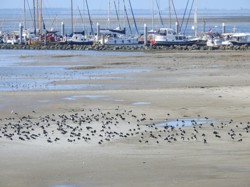
- Salt marshes that are regularly flooded by the tides and provide resting, breeding and feeding grounds for birds. This is a specific strong point of Schiermonnikoog. Already directly at the ferry port and the marina that lies some 2km to the west large groups of birds can be found ‘camping out’. Sometimes species by species (the oystercatchers seem to enjoy their own company), but also in mixed groups.
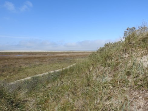
- Coastal sand dunes. The dunes here aren’t as high or spectacular as on Texel, but they can be climbed and will give you good views of the “Rif”.
- Barrier islands: the whole of Schiermonnikoog is one.
- Sandbanks: the "Balg" is only accessible during low tide. Seals can often be seen here.
- Tidal inlets and channels: a number of natural channels or ditches (“slenk” in Dutch) can be found in the southeast of the island. They are not that accessible and can be impossible to cross on foot during high tide.
Where are the birds?
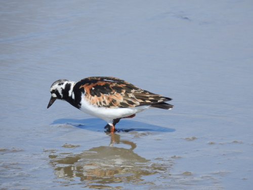
Like Texel, Schiermonnikoog is a great birding site. I was even more lucky here, probably because of the season (May versus January). Several fields were closed to visitors because of the breeding season, but there was plenty to see even from behind the fences. Despite its small size, Schiermonnikoog actually has quite a varied landscape with forests, fields and farmlands in addition to the coastal features. In the forest I saw my first European goldfinch and Coal tit, the farmlands were literally covered with Barnacle geese, in the fields I saw no less than 3 Pheasants and the high tide refuges near the marina were occupied by hundreds of Bar-tailed godwit and Oystercatcher. A first for me here were the Ruddy turnstone (see 3rd photo).
Els - 16 May 2021


