The Baltic Klint is actually the North Estonian Klint, a site that has been on Estonia’s dormant Tentative List since 2004. Although we have put in a good community effort to pinpoint locations (the official description has none), it still takes a fair bit of study to decide where to go and examine these bits of klint. Philipp already put me on the right track, as in his recent review he stated, “The best way to see the Baltic Klint according to my research would be to follow the Saka-Ontika-Toila road to see the Ontika Landscape Reserve.” The rediscovered official website filled in the rest of the details of my visit.
During my late Summer 2025 explorations of Estonia, I visited 4 spots in this area, of which the first 2 hardly deserve a sentence:
- Kõrkküla Klint Plateau: “From the side of Tallinn-Narva Highway at Kõrkküla Village opens a beautiful view”. I found the parking lot here along the main highway, but for me, these were just normal, distant sea views.
- Purtse Klint Bay: “the klint bay narrows from 1.5 km to become an app. 200-m-wide klint valley”. This is mostly a low-lying sandy beach, plus a watchtower that seems to belong to a private villa/hotel. The inlet to the bay can be seen, but again, nothing special to the untrained eye.
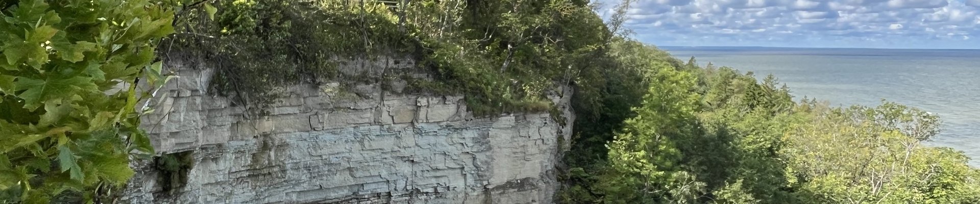
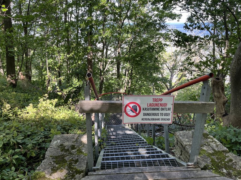
I had higher expectations from the third component on my list: Saka. It is advertised as a “Beautiful trail on the beach, approx. 2.5 km”. It is located next to a recreational area, featuring a restaurant and a small camping site. As it was an Estonian holiday, a dozen other visitors were present. The idea of the walk is that you go down the stairs to the beach, walk along the bottom of the cliff and then take another stairway up again. However, I found the westernmost stairs are “out of service” at the moment.
You can still walk along the ridge at the top, but hardly anything can be seen from here. Maybe the most surprising is how "wild" the forest at the bottom of the cliff is; it is enjoying the micro-climate and the lack of human disturbance. The trail ends at the other set of stairs, which were not closed but so steep (like an enormous ladder) and rickety that I did not dare to go down. Nearby lies Saka waterfall, just a trickle of water, but at least with some exposed rocks.
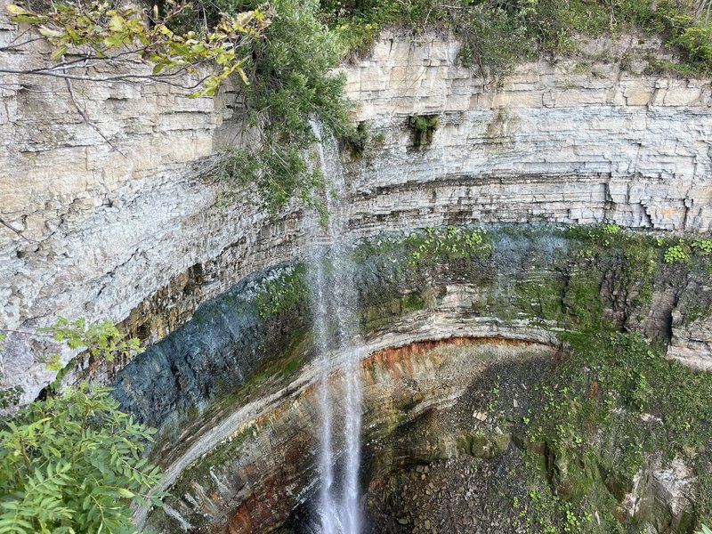
My final component was the 30m high Valaste Waterfall. Waterfalls are a special feature of the North Estonian Klint. The one at Valaste is man-made: the local farmers in the early 19th century needed an outlet for excessive water during rainy seasons. A drain was dug and the water now flows along the cliff face, which it cleans so well that it has exposed sediment layers from the Lower Cambrian to the Middle Ordovician.
The Valaste Waterfall is conveniently situated next to the road, featuring a large parking lot and various amenities. From the top, the cliff is hardly visible and certainly not memorable, but here it is worth it to go down the stairs to the first viewing platform. Not only is the waterfall itself of interest, but its background shows a variety of geologic layers in different colours. Especially the “greenish grey layer” is striking (there’s a blue layer from the Cambrian at the very bottom too, but I did not dare to look down that deep). An explanation of the layers seen can be found here.
So the Valaste Waterfall saved the day for me, but overall, this is a very poor candidate, where it is hard to find out what to look out for and where. Also, the visiting conditions are poor as can be seen from the state of repair of the stairs at Saka, and the one at Valaste (although not closed off) also comes with a warning that the steps have broken down.
Comments
No comments yet.