There had been an 11 and a half year gap between my visits to Struve points, something my friends back home reminded me of as I sent them pictures from a closed cardboard factory the afternoon before, little did they know the treats that awaited them.
The logistics:
Porlom II is located about 100km (1hr30m) North East of Helsinki, just over half way to Verla Board Mill (if you have your own transport) so is fairly easy to combine into a logical trip. Whilst it isn’t impossible by public transport it is highly unfeasible (10 km of walking to and from a bus stop that seems to be served by 1 bus a day at 6:50 am).
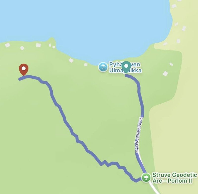
The site is pretty straight forward to find with a small amount of preparation. It is marked from the main road and you just follow a track down to some parking at the nearby Pyhäjärvi Beach (green pin on teh below map), as you drive along you will see a sign saying parking 200m ahead (green sign), this is the actual start of the trail, but you will need to park at the beach and then retrace the road on foot to get to the start of the trail up to the top of the hill (red pin).
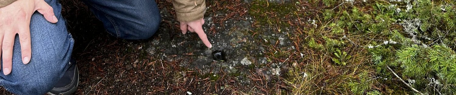
Opposite the parking sign you just drove past you will find a slightly hidden board explaining that there is a Struve point up ahead and useful information about the specific point; it was initially made in 1833, it is a drilled hole in the rock, it was used as a main geodetic station by Finland until the mid-1980s when satellite technology superseded it.
You then just follow the reasonably clear trail up the hill. From the beach to the Struve point it is only about 700 metres, but it took us about 15/20 minutes due to the climb and the stroll through pleasant surroundings.
When we got to the top of the hill the marker was initially hard to find, but eventually we found it at this precise location. Here there is a marker board with the World Heritage Symbol on it.
The actual site
The super specific thing you are looking for is a hole drilled into the rock on which you are standing, it is about 2 meters in front of the board. This was where the pole was initially located to be seen from vantage points on the other sides of the lake of which you now have a lovely view.
I know it's not much of a spectacle but that little drilled hole is the great great grandparent of the GPS that just navigated you to this remote spot with such ease.
I did wonder just how much time the team spent here in 1833, we spent 40 minutes walking to the top of the hill, but they had to scout the location, set up a camp, do the same at the 4 other points from which measurements were taken to create 3 separate triangles. They had to coordinate to take accurate measurements across 10’s kms, all without radio communications. This one little drilled hole was probably the centre of activity for several weeks or months.
Comments
2 comments