
Please bear with me as this is my first time writing a review
Having visited other relatively remote WHS properties in the past, I wasn’t necessarily intimidated by the challenges already pointed out by other travelers, but I tried some new approaches that I think could be helpful for anyone planning to visit now.
Overall Review of the Site
The property spans 5 locations spread out across 3 mountains. Alto de Segovia is, by far, the most impressive with the highest number of hypogea. Out of the other four, El Tablón does not have any hypogea but rather 9 megalithic figures, making it different from the rest, although not necessarily impressive (especially if you’ve visited San Agustín or Quirigua). The Alto de Segovia, Alto del Duende, and El Tablón are easy to reach, but do require a slight hike. Alto de San Andrés does require a muddier hike on a separate mountain, and Alto del Aguacate requires the most strenuous and longest hike, requiring you to reach yet another mountaintop. The hypogea themselves are interesting in their own right, as they are pretty unique, mixing elements of megalithic building (such as at the Antequera Dolmens) with ancient wall painting. Having visited almost every other pre-Hispanic WHS, I have not seen anything similar. Although not necessarily the most impressive thing to view, the setting and the history of the site do help understand the site’s OUV and appreciate the rituals of this yet-to-be-named culture.
Getting There (and Back)
I had read that everyone so far had taken tours from Popayán that would take 1-2 days and about $250. Having very little time and money, I opted to, instead, fly into Pitalito, rent a car, and drive myself out to Tierradentro. The drive to San Agustin was much simpler and very short, so this review will be more detailed as reaching the site proved to be more complex than reaching San Agustín.
There are daily Clic flights from Bogotá to Pitalito, arriving at around noon. From what I understand, Sativa and Avianca may also have flights there, so it’s not a remote airport by any means. The flight was around $200 round trip. I arrived on a Saturday at noon. I rented a car from Presta Cars, a locally owned and operated business. They have a selection of cars and I decided to go for a high clearance car (important to note it was NOT a 4x4). They require a large deposit but it does come back to you after two weeks, pending any traffic tickets or car damage. They brought the car to the airport and also picked it up there, saving me a lot of time. They did require me to show my passport and they took my signature and fingerprint (it wasn’t the most modern of operations). They were very reliable and the cars are equipped with a GPS tracking system. They also were readily available over WhatsApp to answer questions and help out if anything happened. Overall, I felt safe relying on them. The cost of the car was around $270, and I only used one tank of gasoline, bringing the total to about $300 (the cost of ONE tour from Popayán). I do speak Spanish, and I’ve driven in Latin America before, but I have also rented a car from a similar local operation in Georgia and driven to Gelati Monastery—so while I did have an advantage here, I would still have done it had I not had the experience or language. If you’re a bit more of a risk taker and have little time and would like to save $300, then renting a car yourself and driving to Tierradentro is doable (but yes, very risky in terms of what would happen if you got a flat tire or any other inconvenience that could delay your trip).
The drive to Tierradentro from Pitalito was not the easiest. I was lucky in that I had zero car trouble AND I also did not find any closed up sections of the road. There were several sections undergoing road work (which, given the geography, is constant and something you should expect), but I never had to wait over 5 minutes to keep going. Pitalito to Garzón, and then to El Agrado, was very easy, but the road gets tricky after that. About half the time (not distance) of your drive will be spent on dirt roads with mud, holes, and rocks. I also went in early winter, so it hadn’t started to rain heavily yet, making the roads only a little muddy and easily passable. The entire drive took about 5 hours. I left Pitalito at around 1 PM and arrived at my hotel (Bambú) at 6.
You can book several of the hotels online in advance, and the check-in process was very informal. A teenage boy just asked if I had a reservation and let me in without confirming anything. They allowed me to park there car there as well, so I could go explore early the next morning.
Since the road between El Agrado and Tierradentro was complicated, I decided to drive back through Popayán. I knew this would be longer in both time and distance, but given that I was not in a rush (maybe I should have been), and that I wanted to see other parts of Colombia, I took the longer drive. The guides at Tierradentro told me the road to Papayán was in good condition, and the car rental company said the road between Popayán and Pitalito was also in good condition, so I trusted them. Wrong. The road between Popayán and Pitalito is in VERY bad condition. It took me longer than expected and was exhausting. Also, I did the drive AFTER I had visited all 5 locations in Tierradentro, so I was already physically drained. This was a high risk decision that I would not recommend to others. If you do choose to drive to Tierradentro in your own rental, either drive back through Garzón or wait for the next day to drive through Popayán. Driving in a low visibility dirt road at 7 PM with zero phone signal was extremely risky. I got lucky nothing bad happened.
The drive back took about 7 hours total, with me getting back to my destination (hotel in San Agustín) by 9:30.
The Site Itself
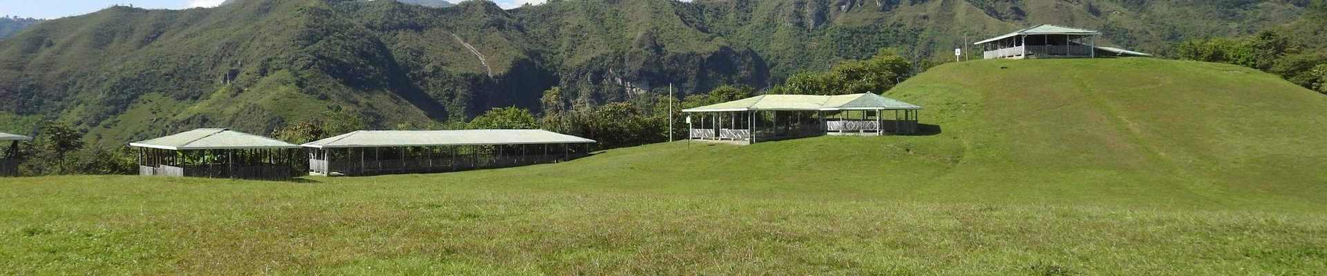
The site is located in an extremely beautiful ecological and geographic area. Completing both hiking loops will reward you with amazing sights of the Colombian Massif, a special region of the tropical Andes where all major Colombian rivers start their journey to the Pacific, Atlantic, and Caribbean, and where indigenous and pre-Hispanic cultures have existed and thrived for millennia.
The structures found underground (hypogea, or the singular hypogeum) were carved into the rock itself as places of secondary burials. The local guide told me he estimates over 300 of these hypogea can be found in the area, although only about 80 have been formally explored (most have been informally opened by looters), and only about 50 are open to the public. I did not go down every single one of them, but I did go down into about 80% of them. They’re all different, but not all as striking or impressive. Most have a light, facilitating the observation of paining and sculpting aspects of the hypogea. Although not much is known about who built them, they do give evidence of a complex, thriving culture that had to coordinate significantly to dig these.
As a note, I decided to track my hikes with my Apple Watch, and tracked my timing via the pictures I took as I hiked. This gave me a more realistic idea of the effort required.
You start the tour at the parks administrative center, which has two museums. The ethnographic museum was closed (but others have said it is less interesting). The archaeological museum was small but informative in preparation for my visit. I arrived right at 8:10 and spent 16 minutes through this museum, before heading up to Alto de Segovia. I reached Alto de Segovia at 8:40 AM. The hike is steep but relatively short, and well paved. If you aren’t keen for hikes, this one is well worth the effort and should be your priority. I spent a good amount of time exploring, talking to the guides, and taking pictures.
After going into about 20 of the hypogea, I headed over to El Duende. I arrived there at 9:35, having left Segovia at 9:25. The hike to El Duende is shorter and not as steep, although it is not paved. El Duende is smaller, with only 4 hypogea. At about 9:50 I left el duende and began the walk to el Tablón, which I reached at 10:28. El Tablón is just off the main road, but the sign is relatively small. You shouldn’t miss it if you’re walking, bu I can see how someone driving might miss it.
El Tablón is the least impressive, although, since it only has statues as opposed to tombs, it’s the most unique of the 5. It takes about 5 minutes to visit, but it’s a nice closing location for the first loop, as it has nice views and you can rest.
You can then head down to the main town, completing the first loop of the visit. This loop took me 2h30m, to cover a distance of 6.82 kms, with an elevation gain of 273m and an average pace of 22:07 per km. Normally, most visitors only do one loop per day, and I was feeling the effort by then, but I only had one day and it was still early (11 AM) so I decided to just go for the second loop and make the most out of my day. I grabbed a quick snack from town and headed over.
The second loop starts with a muddy hike up to Alto de San Andrés, which is at the top of the mountain across from the initial loop. The path was not as clear as in the first loop, and even though it hadn’t rained that much the day before, it was still muddy, so bring good footwear. The hike is also steep, although not very long. Having left town at 11:15, I arrived at 11:30. San Andrés also only has about 5-6 hypogea, but the paintings on them are relatively different, so it was nice to see some variation. After about 10 minutes of pictures and rest, I began the hike to El Aguacate at 11:40.
The hike to El Aguacate is long, steep, and challenging (especially if you’re doing it after having done the other sites). However, the views are extremely gorgeous and rewarding. As a continuation of the hike to San Andrés, it is similarly muddy and sometimes not well signaled. I arrived at Alto del Aguacate at 12:43, almost exactly an hour after leaving San Andrés.
By then, I was extremely tired and it took significant energy to go down into the hypogea and back up—it also felt like the steps were the tallest from all the sites. The hypogea themselves are probably in the worst condition out of all the sites, but they’re also the only location where you can actually go into them and you’re not limited by a metal barrier. That being said, please do not touch anything. These are highly delicate structures, but it’s still nice to be inside one and take a relatively closer look. It is also quite significant to see the hypogea almost in a line following the top of the mountain, making me wonder how far along the mountain they really go. Overall, I believe my hike up to El Aguacate was definitely worth it and helped bring a beautiful conclusion to my exploration of the site. I began my descent at 1:22 PM and was back to the Park HQ by 2:00 PM, just in time to begin my drive back to San Agustín.
The second loop took me 2h52m, covering a distance of 7.71kms and an elevation change of 573m. Overall, as a total for the day, I took 27000 steps, burned 2000 active calories, went up 300 floors, and covered a distance of 17.2kms. I consider myself to be in relatively athletic shape, so I would not recommend doing both loops on one day for an average person, but if you’re an avid hiker (I’m not) or exercise regularly, it is doable (and tiring). One last aspect to consider is the altitude. Although it didn’t make me sick, I did feel like the hike was harder than usual due to how elevated the site is, so if you live near sea level, be prepared to breathe extra hard.
UNESCO-Related Aspects
- The site does NOT have a plaque. The closest thing I could find was (1) a sign indicated this is a protected site according to the Hague in 1954 (not related at all to the UNESCO WHS process) and (2) a hand-painted sign on the wall of the park’s HQ celebrating 30 years of being a WHS. I couldn’t even find the UNESCO logo. This was unfortunate.
- I rated the site 2/5. Although the scenery is incredible, and I can appreciate the adventure of getting there, the site itself is not necessarily the most impressive or unique. It does bear unique witness to a culture, so I understand the nomination, and I can justify the inscription. Although I haven’t been to other hypogeum-focused sites (Malta is coming up), the mix of underground megalithic work and wall painting did seem unique and unlike anything else I’ve seen in the Americas, and even the world. Still, so much is unknown about the culture that created it, it is hard to understand its universal human value. I did gain a greater appreciation for how this region of Colombia has served as a place or protection for different waves of indigenous communities and civilizations to this day, and it was nice to explore a culture that isn’t as well known as the Maya, Aztec, or Inca.
- They do not give you a ticket or physical map of the site. They told me they used to give them out but ran out and haven't gotten a new batch in a long time. I like to keep tickets/maps as souvenirs, so this was also unfortunate. My only souvenir this time around was the wristband, which gives you access to the site for two days and has the name of the site on it. However, it doesn’t have any UNESCO-related symbols, language, or logos.
- The site is, happily, well protected and taken care of, and I was very happy to see that much effort is being placed on preservation, with ongoing investigations lead by Colombian archeologists in collaboration with international researchers. Each location is well-fenced, and the guards to an extremely good job at protecting visitors. Their radio system allows them to give each other a heads up for how many people are going from one location to another. They are also extremely knowledgeable of the history of the site and will happily share any information with you for free (although I did tip a couple of them).
Final Words
Tierradentro was a challenging, yet rewarding, adventure. I did it in a very risky way, but I hope that the detail on the approach from Pitalito can be useful to others in the future. I also hope this can be an easier approach for others who may be limited in time/money, and who want to cover the area and get to see a side of Colombia not many get to see.
Comments
1 comment