Connected Sites
-
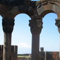
2 locations - the Cathedral Notre Dame/Palais de Tau and Abbey Saint-Rémi - the map even gives serial-ID numbers, but they are not listed as multiple locations. At the map, Palais de Tau also is incorrectly attached to the Abbey Saint-Rémi
-
shown as only having a single location but apparently having 2. "Today,the monuments of Khalifata-bad, which have been partially disengaged from the vegetation, may be divided into two principal zones 6.5 kms apart : to the West, around the mosque of Shait Gurrbad, renowned for its large prayer room, divided into seven longitudinal naves; and to the East, around the mausoleum of Khan Jahan. More than 50 monuments have been catalogued: in the first group, the mosques of Singar, Bibi Begni and Clumakkola; and in the second, the mosques of Reza Khoda, Zindavir and Ranvijoypur." (AB evaluation).
-
The official map clearly shows 2 separate areas instead of 1. For some reason, they made them not contiguous.
-
The map shows a separate, second location across the road. It includes the parking and a police station, so it's unclear why it is in the core zone.
-
AB ev & map insist on 3 separate areas. UNESCO shows 6 different locations, of which the 6th (Cemetery of Congregation) is especially doubtful for a separate location.
-
UNESCO lists 2: the parks in RSA and Lesotho. However, these are contiguous. There is a fully separate component, though, far north: it consists of the combination of Rugged Glen Nature Reserve and Royal Natal National Park.
-
No locations listed at all, but the revised map from 2014 clearly shows 2 different areas.
-
No of locations not clear. The "Reactive Monitoring Mission" of 2012 had considerable difficulty in establishing boundaries for the property using documentation provided from the time of inscription onwards. The UNESCO Web site description makes it clear however that there are at least 2 separate inscribed areas "In the modern town of Soûr, the property consists of two distinct sites: the one of the town, on the headland, and the one of the Necropolis of El Bass, on the continent."
-
It was nominated as a serial site with 31 components; the UNESCO website currently shows 30 components, and Tunisia's 2024 SOC report had 32. A “Zone Côtière inhabitée” was added in the northwest, while Khazroun / Sedghiene / Guecheine are seen as one by UNESCO, where they are separate elsewhere.
-
2 locations - no indication of a separate serial ID or map
-
There seems to be only 1 official location, but it consists of multiple elements that are not contiguous. Protected Planet shows them as 9 separate areas.
See www.protectedplanet.net
-
UNESCO map page lists 2 marine areas without coordinates. These are not separately visible on the maps. They are also not mentioned in the nomination dossier, except for one "marine area", without coordinates as well, apparently just to show the size of the marine area versus the terrestrial area.
-
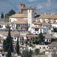
Website shows 2 locations (because of the later addition of Albayzin), but core zone is one integrated area and this wasn't nominated as a serial site
-
The description mentions 7 locations but these have not been identified as such with UNESCO ID numbers and there's no clear map.
-
2 locations- Main Cavern area, Rattlesnake Springs
-
The UNESCO website shows 8 locations, but #8 Kaya Kinondo was explicitly excluded upon inscription (see link for decision). Also, the text mentions 10 components: there is a set of 3 that has been grouped into 1.
See whc.unesco.org
-
Comprises 2 separate areas: Wrangel Island and Herald Island
-
Recorded by UNESCO as being a single "location" but in fact contains an "exclave". "The only exclave is the rounded top of the hill called the Rochusberg near Bingen." (Nom File). THE AB evaluation describes how the nominated boundary was altered during evaluation - "During the expert mission the delimitation of the nominated area in Bingen was discussed and it was agreed that this should be slightly modified. The State Party has relocated the boundary at the Drusus Bridge, one of the oldest medieval stone bridges in Germany (on the site of a Roman bridge) which spans the Nahe tributary, so as to include the church of St Martin." But, as the registered map shows, this extension up the Nahe still doesn't reach the westernmost section of the Rochusberg and is separated from it by the L417 road.
-
UNESCO has 1, but there are 7 separate areas shown on the map (1 main location and 6 numbered units in the buffer zone)
-
3 locations listed, but the map for location 2 shows more parts that are isolated from others by the buffer zone
-
The list shows 5 locations, of which one is: "Naurzum State Nature Reserve – NSNR Eco-Corridor linking the upper cluster (only buffer zone)". On the map, it is clearly shown as separate and in a different colour from the core zone, and the number of hectares in the core zone according to the AB ev is 0. So this is not an official component as we see it, it is only a special kind of buffer zone.
-
Shows 20 (those of the 2015 extension), but these include 4 main routes and 16 individual sites that represent those routes. The original main route is omitted, and there are 1912 "associated sites" as well.
-
The Upper Harz Water Management (2010 extension) has only one ID but multiple locations. The nomination file lists 719 ponds, ditches and water tunnels (several of them may be contiguous, but there are still plenty of different locations), plus specific monuments such as Walkenried monastery, Samson mine, Rosenhof wheel chambers, Knesebeck Shaft, Ottiliae Shaft, Kaiser Wilhelm II Shaft.
-
Component "Paysage et ensemble miniers de la Bleuse Borne" of the Nord-Pas de Calais Mining Basin WHS is missing from the UNESCO website. It should be component #10, between "Cité du Rivage ancienne" and "Château Dampierre." It actually disappeared between pages 7 and 8 of the nomination dossier!
-
The official map shows a tiny exclave: Kodamado - Hall of the Small Pearl, which is not listed as a separate location to the main one.
-
The actual number of locations is unclear. The UNESCO website shows none, the ICOMOS evaluation speaks of 'a site', the IUCN evaluation refers to the process of simplifying the boundaries, and the official maps show 7 islands with parts in- and excluded.
-
no separate map, but the maps in the nomination file (page 50/51 and 95/100) show about ten different areas of various size
-
UNESCO reports none, which suggests it is a single contiguous area. However, Junquillal Wildlife Refuge is clearly a separate component. Also, there is a mysterious component in the south (with a spot called Puesto La Virgen) which has appeared after the extension of the site in 2004.
-
UNESCO page lists 41 components, including Prison Purposes Land without coordinates. Nomination records (in 2 stages) are poor, but in the 2024 SOC Australia speaks of 40 individual components. Also, the only map available (in that same SOC) omits other components in the west.
-
Although the description mentions 8 locations these have not been identified as such with UNESCO ID numbers
-
15 locations not 10 - Locations 1215-003,5,6,8 and 10 each consist of 2 geographically separate locations numbered "003i" and "003ii" etc
-
No indication of a separate serial ID for the locations that are shown on the (old) map. Extension from 8 to 13 sites in 2015 not acknowledged.
-
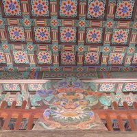
2 locations - the fortified town centre and the small Jewish quarter - the map is not detailed but shows two different locations
-
UNESCO does not show a split in locations and the AB ev also does not hint on it, but the map shows 2 core zones with 1 buffer zone.
-
No of locations not clear. We know that between 10 and 13 buildings were inscribed. Whilst some may be "adjacent" to and therefore potentially in the same "location" as another, others are widely scattered around or many kms from Kumasi and therefore must be separate "locations"