Connected Sites
-
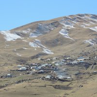
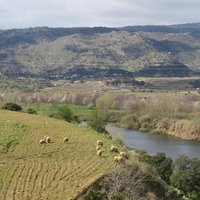
Incense & Spice Route (between Ovdat and Moa)
-
Le Strade Nuove
-
-
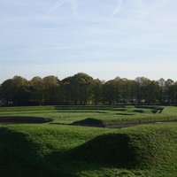
The core zone only exists of the rectangular wall, over 2km long and 4m wide
-
The WHS follows the meandering Zuo and Ming rivers. (Maps on Unesco website) – "Linked by the Zuojiang River and Mingjiang River, they present a "one belt and multiple spots" layout." (Nomination file, p. 54)
-
Thin strip along the coastline
-
-
-
"six kilometre north-south axis"
-
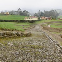
The Transhumance Route
-
-
-
-
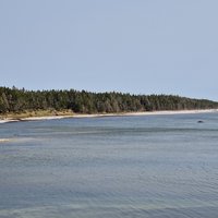
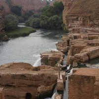
The WHS follows nearly all the coastline of Anticosti island, and includes the Jupiter and Vaureal river valleys. "The roughly ring-shaped exposure around the coastal perimeter of the island features the entire Ordovician – Silurian interval for which the property is nominated." (IUCN Ev) – "(...) le bien proposé pour inscription s'étend sur près de 550 kilomètres de côte, soit la totalité de la rive de l'île, à l'exception du village de Port-Menier, et inclut le lit majeur des rivières Jupiter et Vauréal." (Nomination file, p. xxvi)
-
The AB evaluation states "It may also be considered to be a linear Cultural Landscape, as defined in the Operational Guidelines (1995, paragraphs 35-39)". The full artifact is described thus :- "The defensive line of the Stelling van Amsterdam is roughly Circular, on a radius of approximately 15 km from the city centre, and extends over two provinces. The main defence line is c. 135 km long and comprises 45 forts, with a number of ancillary works." It is not absolutely clear however whether the inscribed area is linear or consists just of specific points -or a mixture. The AB eval states "The area proposed for inscription runs continuously in a 3-5 km wide zone from Edam, north of Amsterdam, to Muiden, to the east of the city, and out to the PamPuS island fort in the IJmeer, Passing through twenty-six municipalities. It includes forty-five forts and many smaller works."
-
-
The entire 1394kms length is inscribed
-
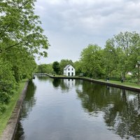
Core zone follows the river and canals
-
A narrow strip along the coastline
-
Along the Western Front of WWI
-
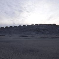
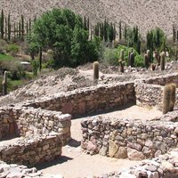
The Thirteen Towers are a row of thirteen cuboidal constructions built of stone and mortar along a low ridge roughly at the center of Chankillo. (Nomination Text, p. 17) The regularly-spaced thirteen towers of Chankillo were constructed atop the ridge of a low hill running near north to south, forming a "toothed" horizon with narrow gaps at regular intervals. To the east and west investigators designated two possible observation points. (wiki)
See en.wikipedia.org
-
-
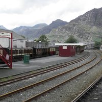
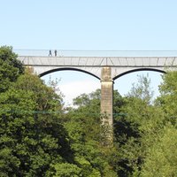
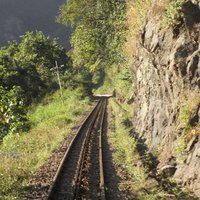
The Ffestionog and Tal-y Llyn railways
-
Especially San Luca, Strada Maggiore and Certosa locations
-
Most of the inscribed sites consist of linear areas 30m either side of the tunnel.
-
Canal du Centre
-
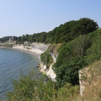
Follows the narrow coast line for 15km
-
-
-
41 kms long. "It may also be considered a Linear Cultural Landscape as defined in the operational guidelines 1995 paragraphs 35-39" (AB)
-
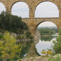
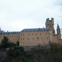
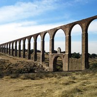
The total "width" of the site consists solely of the aqueduct for around 12kms kms beyond the town centre of Segovia as far as the mountains where it commenced at the Fuente Fria.
-
"It may also be a linear cultural landscape, as indicated in paragraph 40 of the Operational Guidelines" and "In addition, seven stretches of the Chemin du Puy are included in the nomination ".(AB)
-
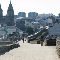
It is not absolutely clear whether this site is inscribed as a series of point monuments or in the form of a "line". The AB eval states "The entire route from the French Frontier to Santiago itself has been nominated" ..... "At the present time a 30 mtr strip on either side of the route is protected"
-
-
-
-
"The nominated property consists of the whole length of the canal and its banks; 17km of its 18 km length is in Wales and 1km in England. It includes the towpath and adjacent buildings directly connected with its history" (AB)
-
Focus is on the linear stretch of the Seine
-
-
Darjeeling Himalayan, Nilgiri and Kalka-Shimla railways
-
"The Lower German Limes was the earliest linear frontier of the Roman Empire" – "The component parts of the serial property have been selected to represent the linearity and attributes of the Frontier, demonstrating the early development of the perimeter defence." (Official description)
-
described as "a 200-km linear cultural landscape along the Loire River between Maine and Sully-sur-Loire"
See www.georgewright.org
-
-
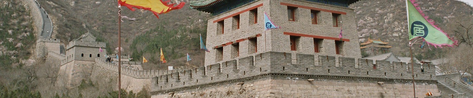
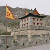
It is not absolutely clear how much of the totality of defensive walls within China are inscribed
-
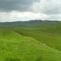
Hadrian's Wall, Antonine Wall
-
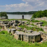
"(...) the fortifications consisted of a continuous chain of military installations almost all along the southern banks of the river. The backbone of the defence system was a string of legionary fortresses". (Brief synthesis)
See whc.unesco.org
-
-
"The total length of the waterway that is the subject of this nomination is 360 km."... "It should also be considered to be a cultural landscape of the type Proposed in paragraph 39 of the Operational Guidelines for the Implementation of the World Heritage Convention, although it was not nominated as such by the State Party". (AB)
-
It does include 4 "linear" stretches of road -some are less than 1km but there is also "Stretch of Camino Real between Nazas and San Pedro del Gallo This 64km stretch is the longest that has been preserved." (AB) It is described as a "Heritage route" rather than a "Linear Cultural Landscape"
-
aligned on a 1.5-kilometre-long axis (AB ev)
-
-
-
see map in nom file
-
-
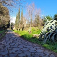
"a series of linear component parts attesting to the course and structure of the Via Appia" (AB ev)
-
-
202 km route (AB ev)


