Connected Sites
-
The UNESCO Maps of Reims and Epernay show the inscribed areas as pink for overground and a blue line for underground (The "Caves"). The latter sometimes extend beyond the former – but are always within the buffer zone (Orange)
See whc.unesco.org
-
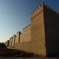
• " In response, the State Party submitted a new, three-dimensional boundary concept on 25 February 2019. In this revised delimitation, the outer boundaries remain identical while a number of 20th century constructions have been excluded above-ground – thereby becoming islands of buffer zone within the property – while potential or known archaeological resources below these remain explicitly within the property. Excluded are numerous areas including the three artificial hills with Saddam Hussein’s palace located on the westernmost side, the contemporary village housing located within the property, individual government buildings such as the police headquarters and conference centre, as well as manifold others..." (Advisory Body Evaluation, 2019)
-
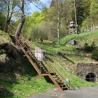
Both have mainly underground boundaries
-
See Nomination maps for "Nominated property underground" in blue extending beyond the boundaries at the surface
-
See UNESCO Map with solid lines for "Surface Nominated property" and dotted lines, extending way beyond these, for "Underground Nominated property (Protected at surface)". (It is not clear whether this "protected at surface" means that the surface is an "official" (UNESCO) buffer zone)
See whc.unesco.org
-
Beyond the boundaries of the inscribed surface areas there are numerous underground elements some of which are not even included in the surface buffer zone. See (link) which show dotted lines for "Nominated property underground" extending way beyond any inscribed overground zone. E.g the entire element of Dippoldiswalde Mediaeval Silver Mine (1-DE) and the Freiberg location (4-DE). The Nomination file states - "On the Saxon side, in some cases, for linear elements a standardised buffer zone between 5 and 10 meters in width was determined. Structures located underground were only allocated with a buffer zone when these are reflected by function-specific installations or archaeological remains above ground. Otherwise, above ground (construction) measures will have no effect on these mostly very deep-lying structures."
See whc.unesco.org
-
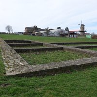
Most of the sites are buried, with possible reconstructions above ground not included in the core zone.