WHS Plaque Collection
The Operational Guidelines of the World Heritage Convention state that "Once a property is inscribed on the World Heritage List, the State Party should place a plaque, whenever possible, to commemorate this inscription".
There are suggestions about how the Plaque should look like, but in reality they vary a lot. On this website we consider as WHS Plaques all markers and information panels found at or near UNESCO World Heritage Sites, that have at least several of the following elements: the UNESCO WH emblem, the official site name, the term "World Heritage Site", the year of inscription, and the reason for inscription (OUV). It doesn't include WHS Inscription Certificates (paper documents, often found framed in a museum or visitor center).
This collection has been brought together as a community effort. It's a work-in-progress: updates can be found and shared at this Forum topic .
The newest additions can be found below. You can view all plaques, ordered alphabetically by country, via following the links:
A-DE-H I-L M-P Q-U V-Z
Recently Added WHS Plaque locations
| Site | Plaque location | Image |
|---|---|---|
| Ahwar of Southern Iraq The Central Marshes | Large marble plaque with all elements at the entrance to the Martyrs Monument. 30.978878, 47.042675 | 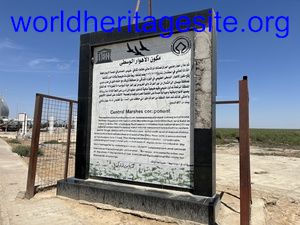 (photo by Els) |
| Tomb of Askia | Right in front of the tomb | 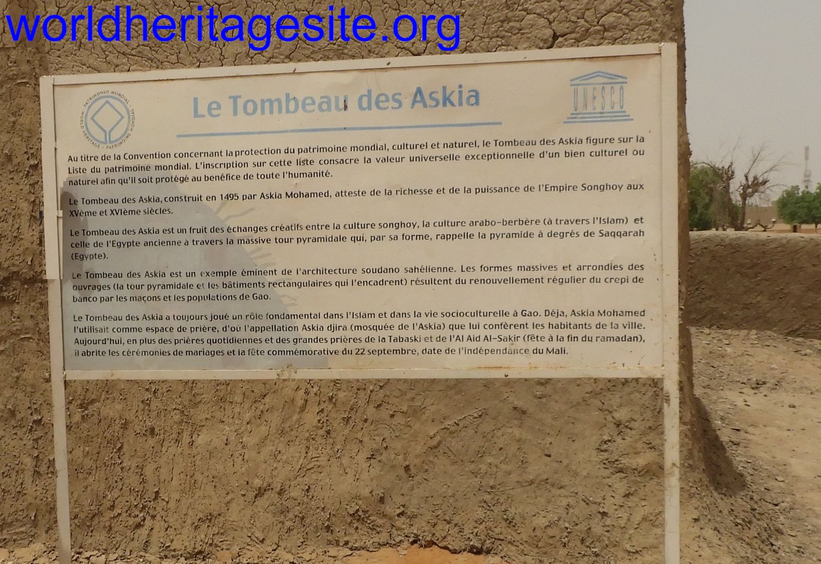 (photo by Roman Bruehwiler) |
| Beijing Central Axis | To the left (east) of the entrance to the area of the Drum Tower. 39.93992, 116.38978 | 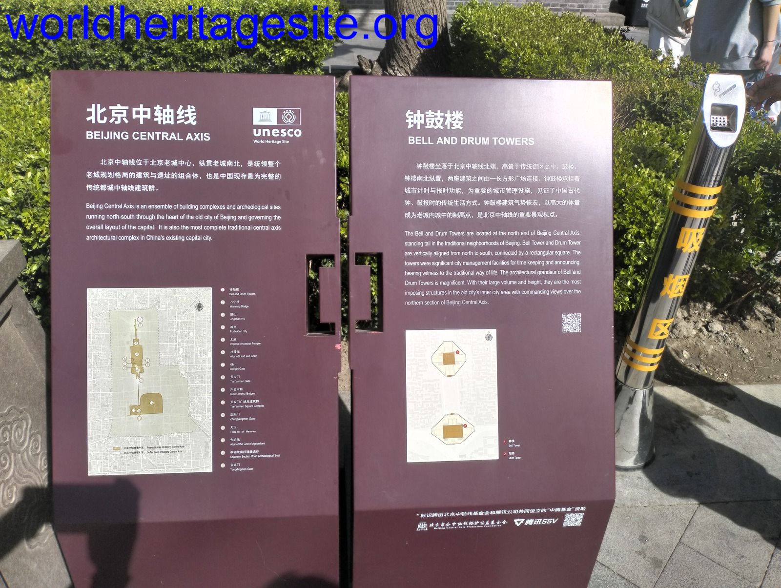 (photo by Shwabb) |
| Choirokoitia | Wooden welcome sign |  (photo by Argo) |
| Forts and Castles Gold Coast Elmina Castle (St. George's Castle/ Fort St. Jorge) | Weathered white sign with emblem and year | 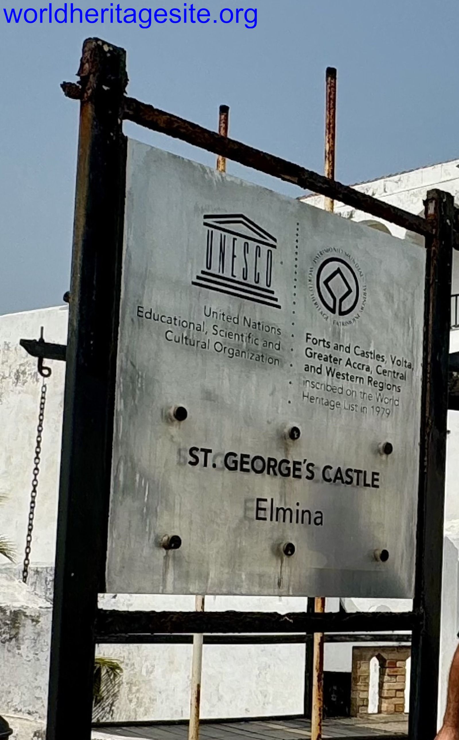 (photo by Bram de Bruin) |
| Asante Traditional Buildings Besease | Newish white plaque with emblem and year, right at the corner leading towards the building | 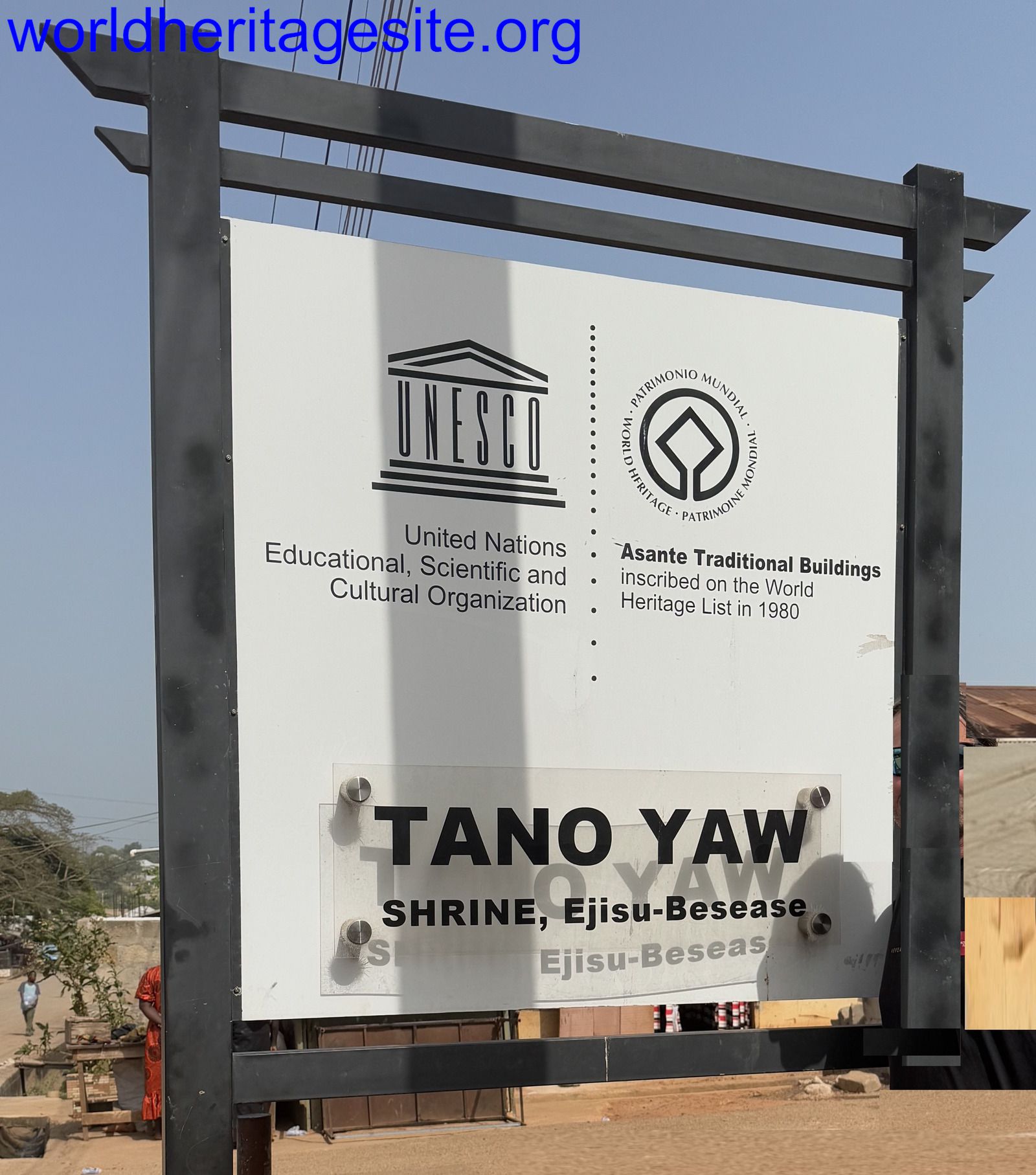 (photo by Bram de Bruin) |
| Mount Qingcheng and Dujiangyan | All information panels have the emblem and WH indication No full plaque? |  (photo by Els) |
| Jiuzhaigou Valley | Welcome Stone with emblem and site basics | 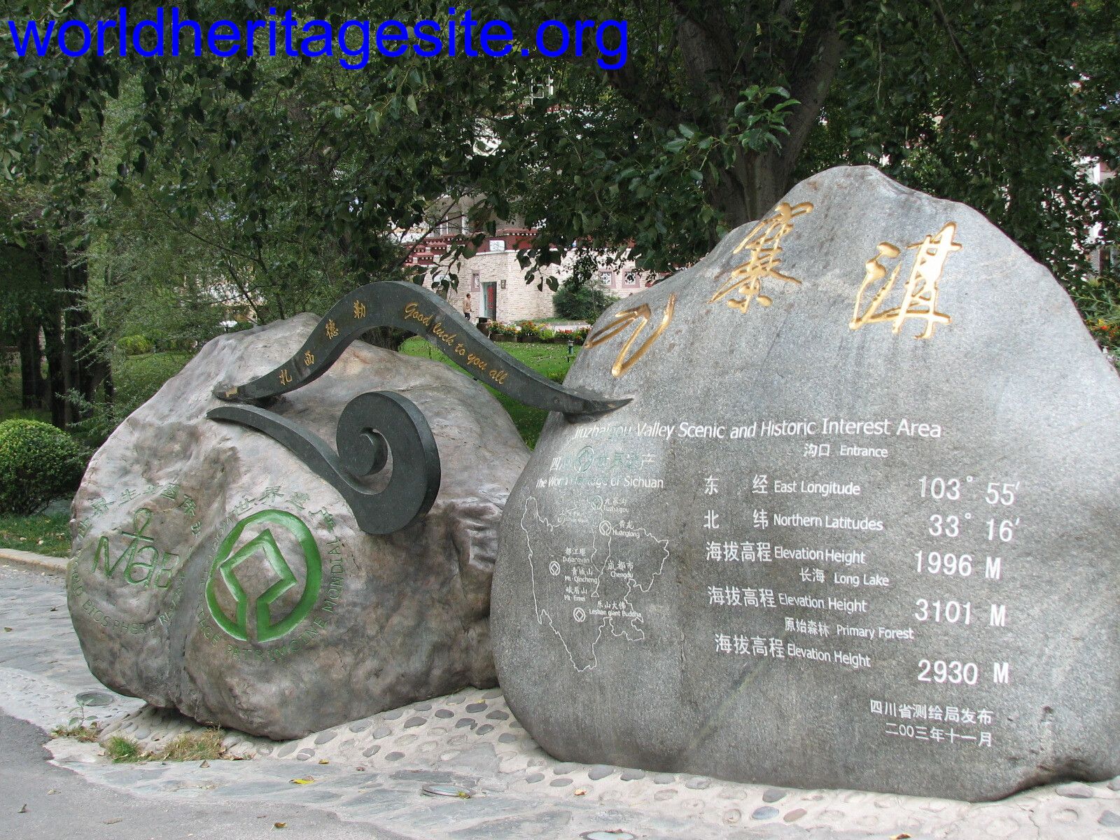 (photo by Els ) |
| Island of Mozambique | Blue welcome sign | 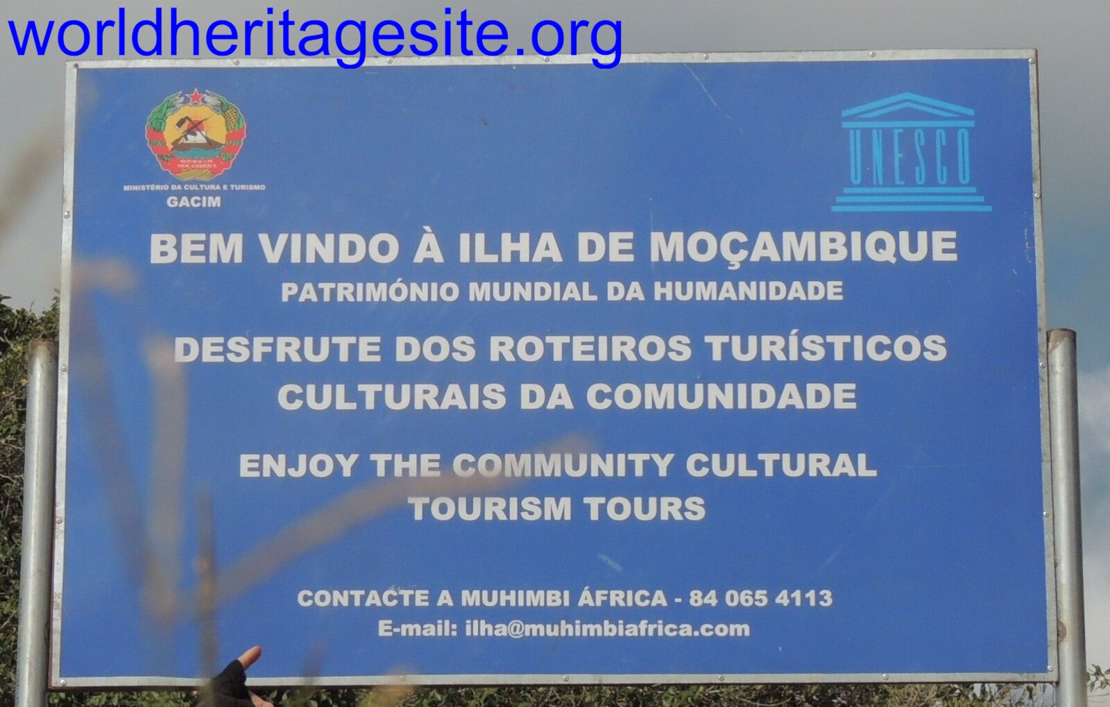 (photo by Roman Bruehwiler) |
| Macao Zone 1 (Between Mount Hill and Barra Hill) | On the east side of the pedestrian street down the stairways of Ruins of Saint Paul's. Contains WHS emblem, a map of the property and a copy of the certificate, missing OUV. 22.196914, 113.540948 | 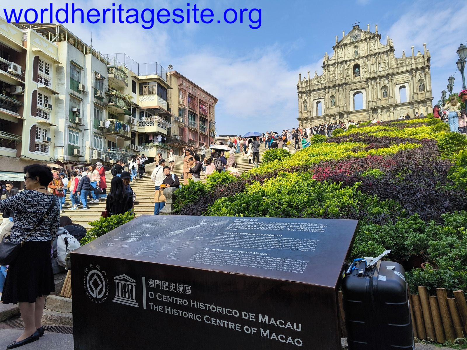 (photo by Pchxiao) |
| Orkhon Valley | On the slope of a hill to the southeast of the town of Kharkhorin, with an overlooking perspective on the town and the Erdene Zuu, next to the "Turtle Marker" POI on Google Maps; WHS emblem in the front, a copy of certificate and a map of the property in the back, missing OUV. 47.181753, 102.850850 | 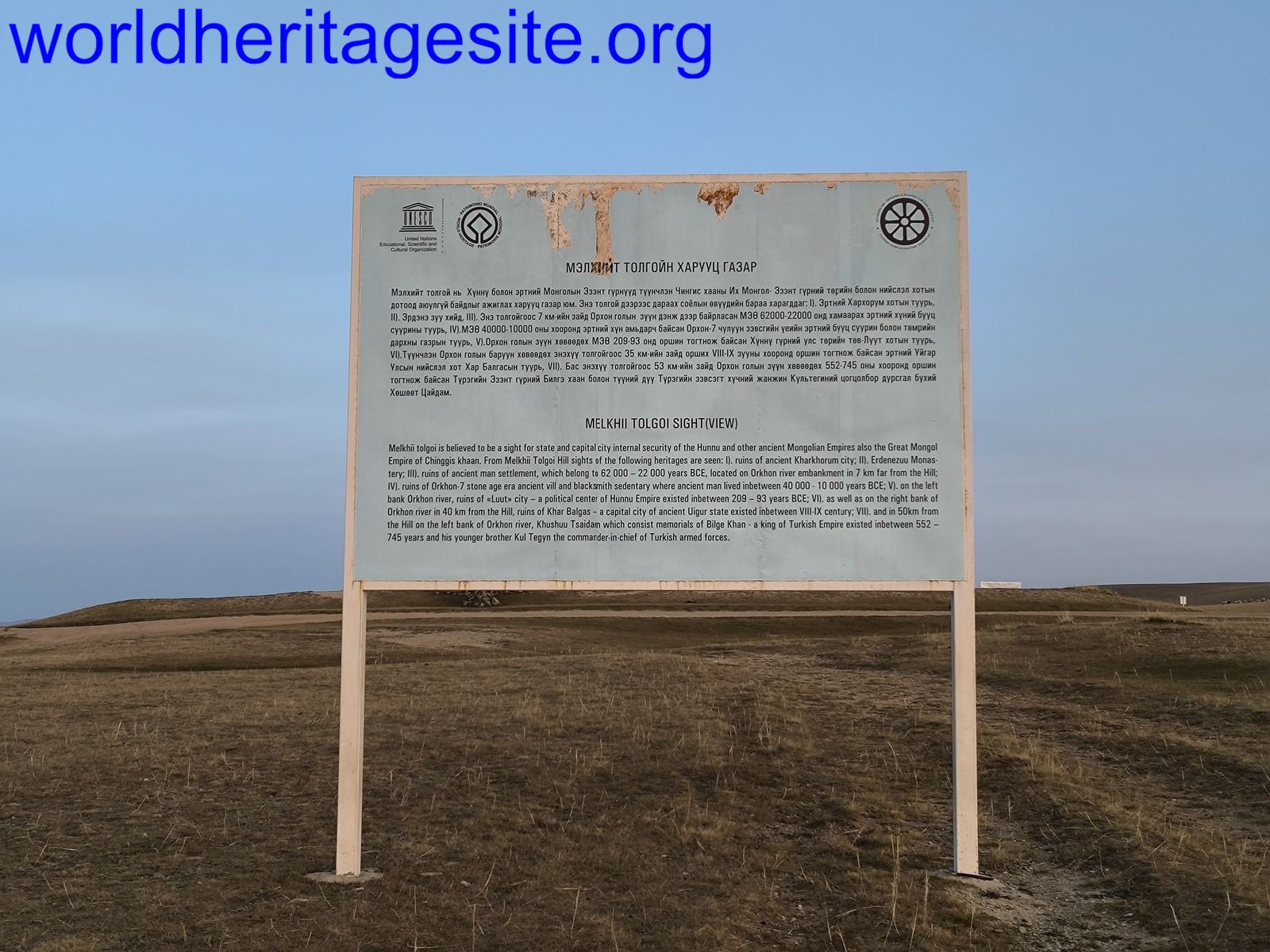 (photo by Pchxiao) |
| Vat Phou | Wooden board at the entrance to the site, no year or OUV stated 14.8467598, 105.8276255 | 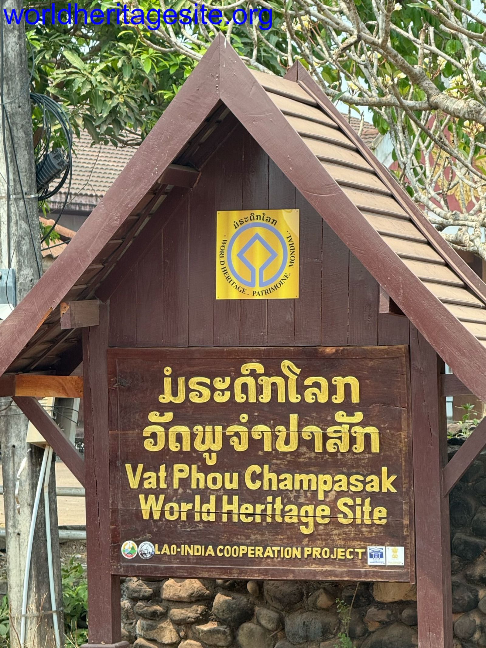 (photo by Christravelblog) |
| Van Nellefabriek | Brown road sign. No plaque at the site itself? 51.926988, 4.397488 | 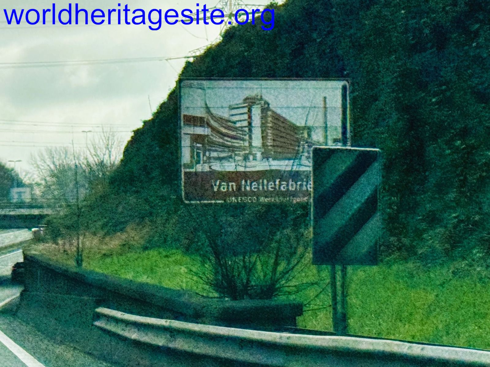 (photo by Bram de Bruin) |
| Phu Phrabat The Phu Phrabat Historical Park | Typical Thai plaque with emblem and location name, at the garden of the visitor center. There's a similar one along the entrance road. 17.7305076, 102.3577734 | 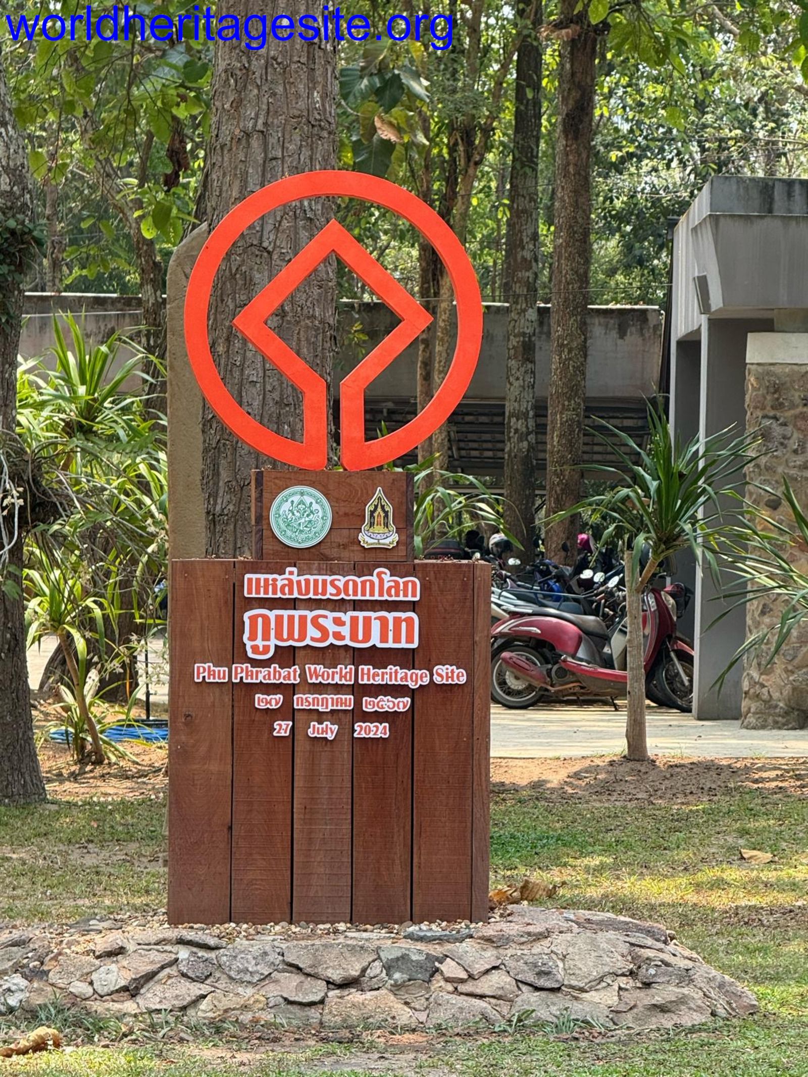 (photo by Christravelblog) |
| Phu Phrabat The Sīma Cultural Site at Wat Phra Phuthabat Buaban | Typical Thai plaque with emblem and location name 17.6303394, 102.3320584 | 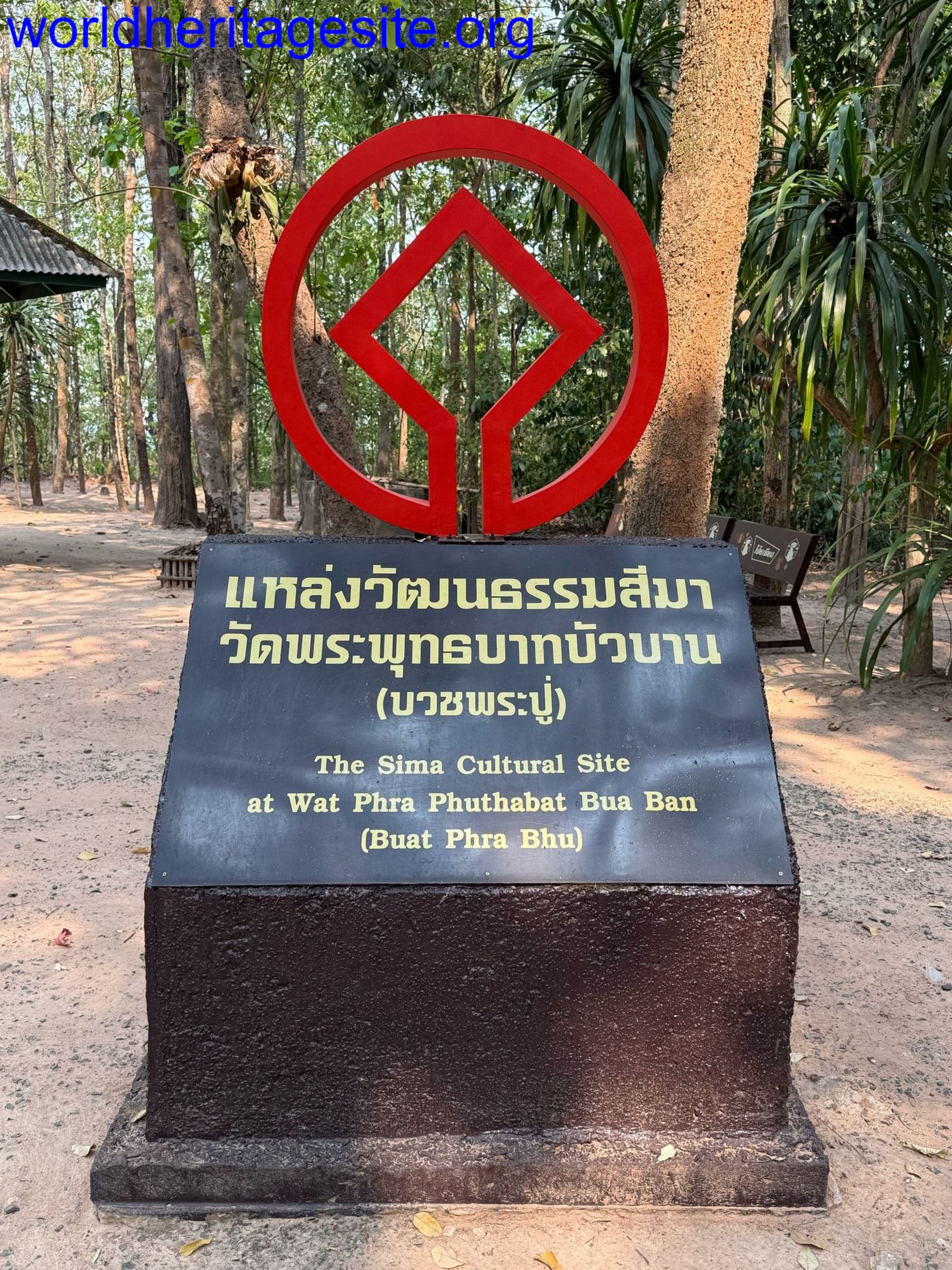 (photo by Christravelblog) |
| Decorated cave of Pont d'Arc | At visitor center replica cave, including all elements | 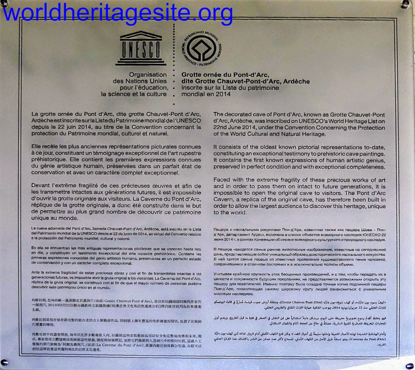 (photo by Solivagant) |
| Stari Ras and Sopocani Monastery of Djurdjevi Stupovi | Metal marker with all elements except OUV | 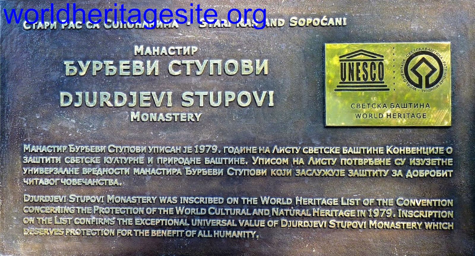 (photo by Solivagant) |
| Ravenna Archiepiscopal Chapel | Shield with information in Italian, including all elements except OUV | 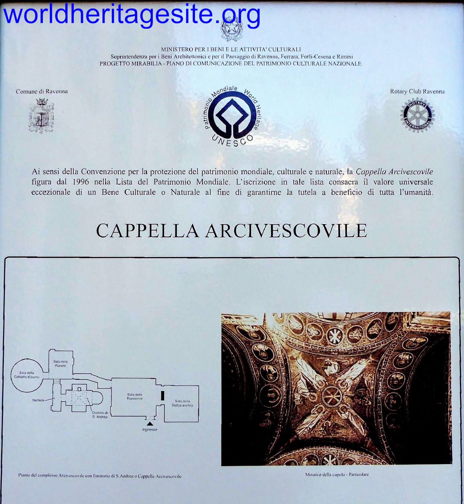 (photo by Solivagant) |
| Ferapontov Monastery | Yellow sign just outside the monastery walls | 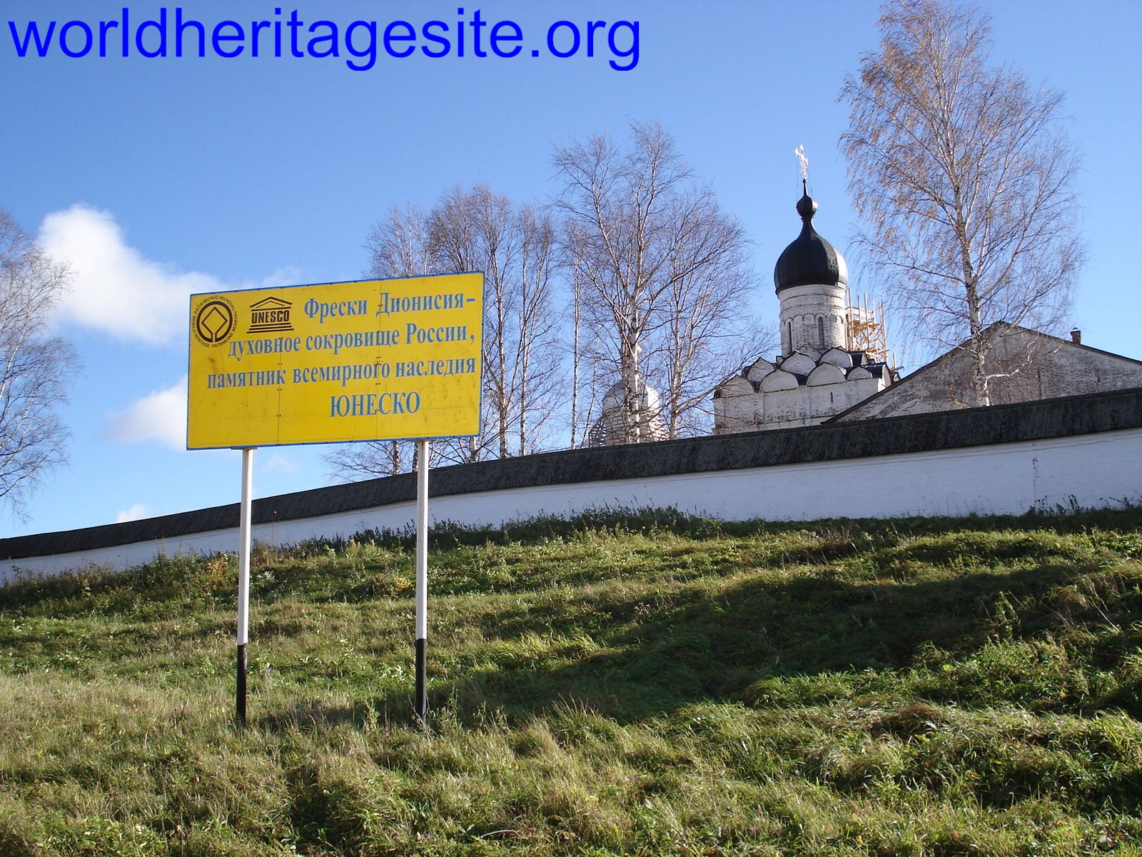 (photo by Jarek) |
| Odesa | White perspex plaque with all elements except OUV 46.48508, 30.74314 |  (external source) |
| Gebel Barkal Gebel Barkal | Welcome sign in the desert while approaching the site |  (photo by Els) |
| Koutammakou | At the ticket office | 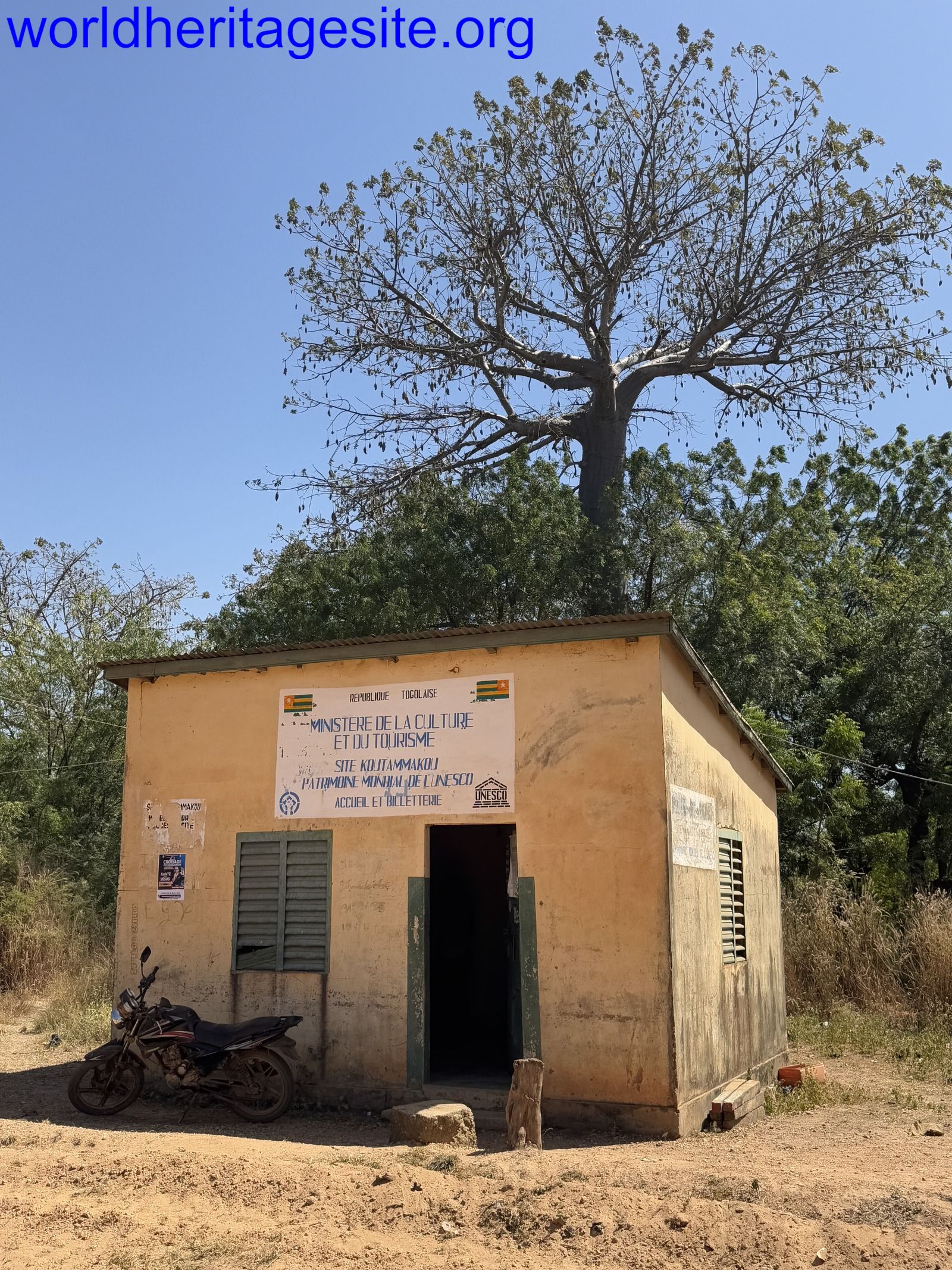 (photo by Bram de Bruin) |
| Palau de la Musica Catalana & Hospital de Sant Pau Hospital de Sant Pau | Information panel in front of hospital with most elements | 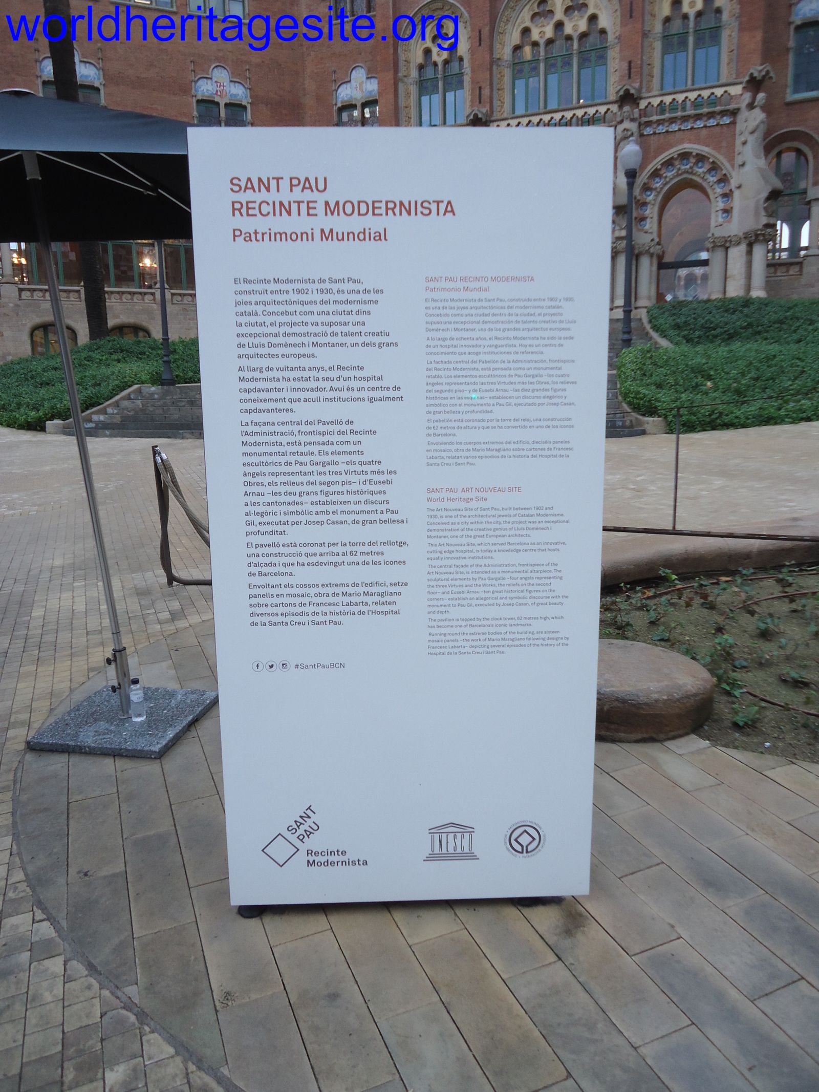 (photo by Jarek) |
| Taputapuātea | Wooden plaque with emblem and year of inscription |  (external source) |
| Land of Frankincense Archaeological site of Shisr | Red welcome sign May not be present anymore, photo taken in 2010 |  (photo by Jarek) |
| Australian Convict Sites Hyde Park Barracks | Welcome sign at entrance | 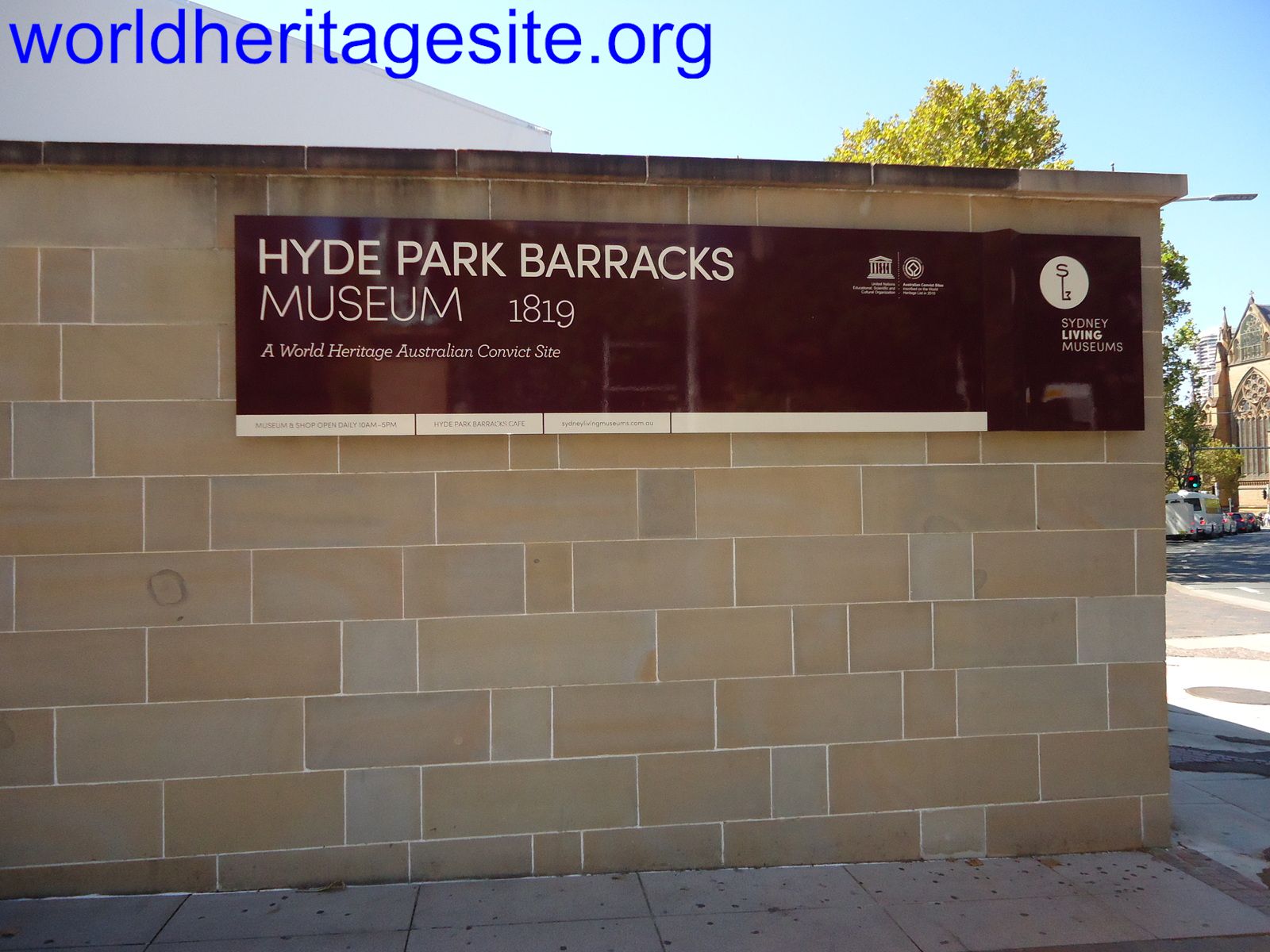 (photo by Jarek) |
| Australian Fossil Mammal Sites Naracoorte (Hynam-Caves Rd) | Information panel at entrance with all elements | 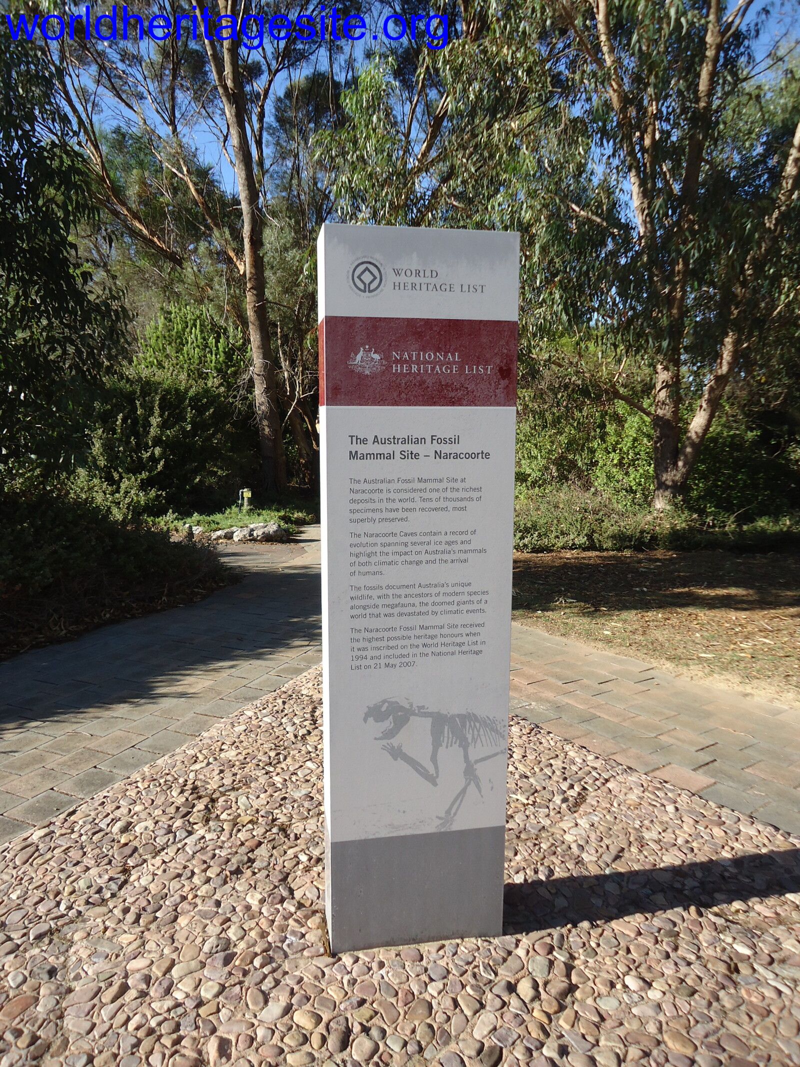 (photo by Jarek) |
| Djoudj | Small handpainted plaque next to the information panel Photo taken 2018, may not be present anymore | 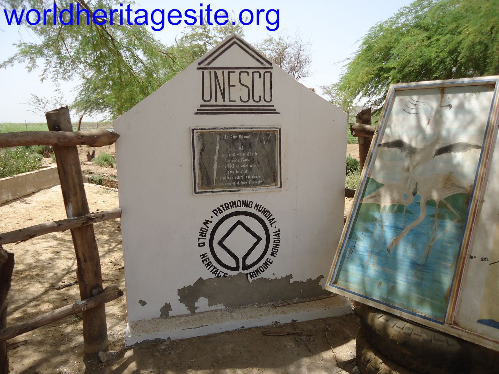 (photo by Jarek) |
| Tiya | Weathered welcome sign Photo taken 2014, may not be present anymore |  (photo by Michael Novins) |
| Tierradentro El Tablon | Information panel with emblem, name (found at all locations). | 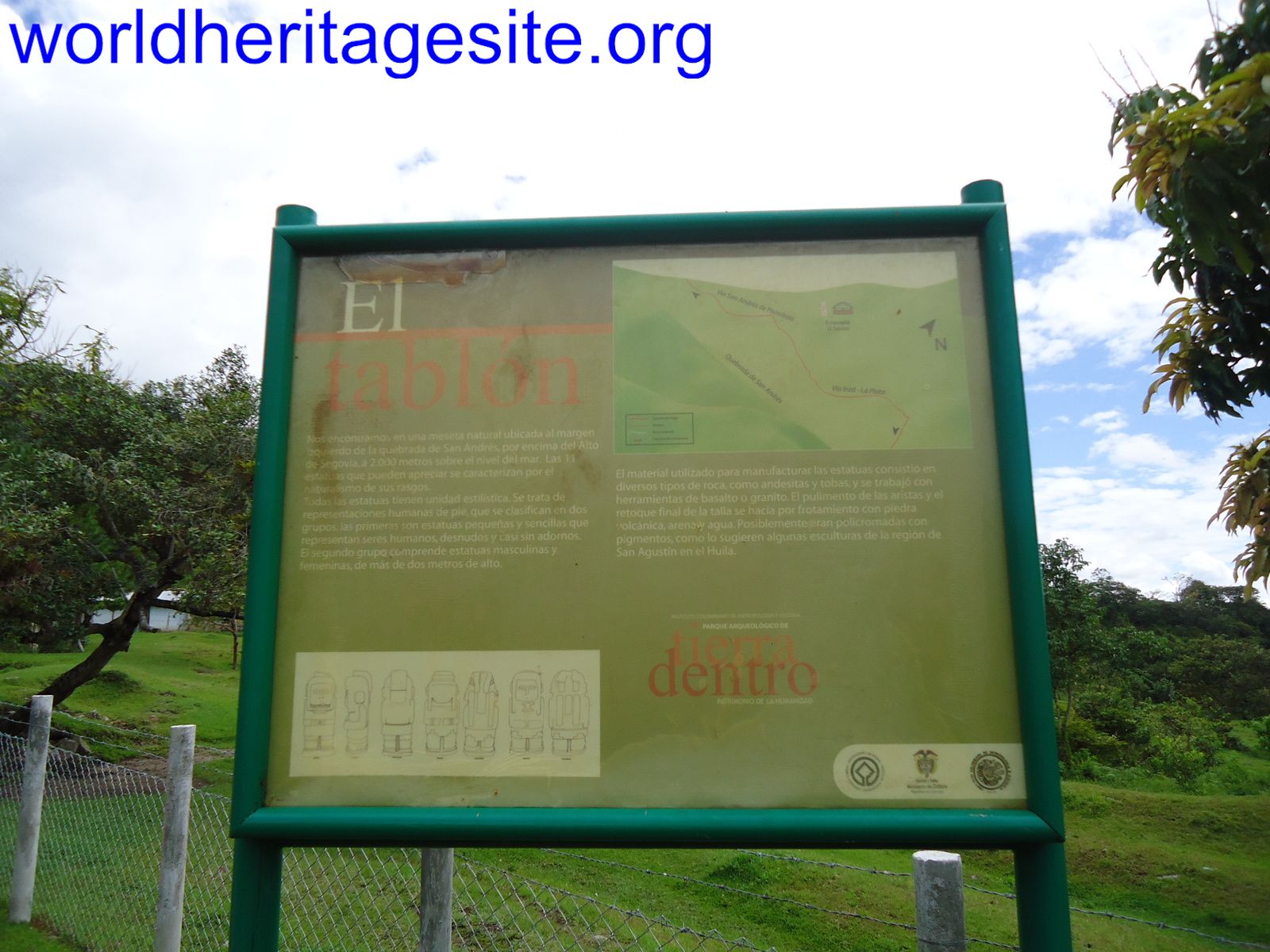 (photo by Jarek) |