Cuba
Cuban Caribbean Reef System


The Cuban Caribbean Reef System is an 800-km-long system stretching from Guanahacabibes Peninsula in westernmost Cuba to Jardines de la Reina in southern Cuba.
It includes 9 protected areas comprising the main marine areas in Cuba and the most important ones in the insular Caribbean due to their extension, natural values and conservation status.
Site Info
Official Information
- Full Name
- Cuban Caribbean Reef System (ID: 1802)
- Country
- Cuba
- Status
-
Nominated 2027
Site history
History of Cuban Caribbean Reef System
- 2023: Preliminary Assessment
- 2003: Added to Tentative List
- Added to tentative list
- 2000: Revision
- Was included in the former TWHS the Alps (2005).
- Type
- Natural
- Criteria
- vii
- x
Links
- UNESCO
- whc.unesco.org
- Related
-
- cubanaturetravel.com — Cuba Nature Travel: Undersea Parks
All Links
UNESCO.org
- whc.unesco.org — whc.unesco.org
Related Resources
- cubanaturetravel.com — Cuba Nature Travel: Undersea Parks
Community Information
- Community Category
- Natural landscape: Marine and Coastal
Travel Information
Recent Connections
News
No news.
Recent Visitors
- Pieter Dijkshoorn
- Truls Brekke
- Riccardo Quaranta
- Stanislaw Warwas
- Van Hung
- Wojciech Fedoruk
- Szucs Tamas
Visitors of Cuban Caribbean Reef System
Community Reviews
Show full reviews
The place isn't very easy to see. Of all the proposed locations, only two are on land – one is the Punta Frances and Punta del Este National Parks on Isla de la Juventud (accessible by ferry from Surgidero de Batabano or by plane from Havana), the other is Guanahacabibes National Park on the southwestern tip of the main island. After visiting Viñales, I decided to see what this place had to offer.
The road from Viñales is terrible – no wonder Google Maps shows 3 hours for only 137 kilometers (from Havana, it's almost 5 hours). Along the way, we pass the Sacred Heart of Jesus Church in Sandino, built in 2018 – the first church built in Cuba after the Cuban Revolution in 1959!
The closer to Guanahacabibes, the worse the road, but it's accessible by regular car. The last major town is Manuel Lazo; the park boundary is about 20 km further, and after a few minutes of driving, you can reach a small Visitor Center.
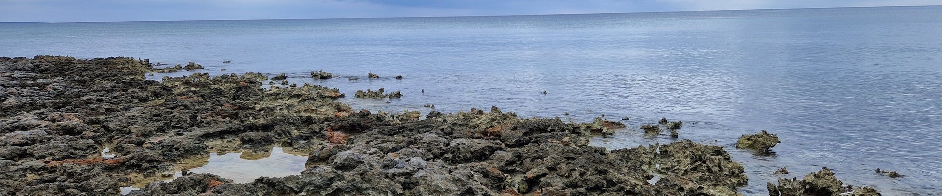
Unfortunately, everything was closed during our visit; I just looked through the windows and continued on. Unfortunately, after another few minutes, I reached a barrier. Access was only permitted with a guide. Fortunately, the ranger's hut was right by the sea, and there was a coral reef on the shore. So, at least I had a glimpse of the core zone of this entry. Unfortunately, the reef was largely extinct and fossilized, although some living organisms could be observed.
After my …
Keep reading 0 comments