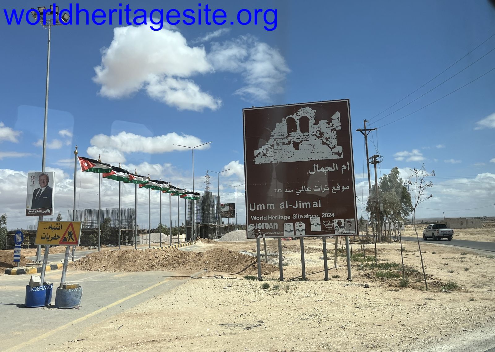
Umm Al-Jimāl

Umm Al-Jimāl comprises the well-preserved remains of a rural settlement on the Hauran plateau dating back to the 5th-8th century.
Its non-monumental architecture evolved organically, with the construction of churches and houses in a distinct local basaltic style and the reuse of buildings left by the Ancient Romans. Its buildings' pragmatic and durable character reflects the agro-pastoral lifestyle of the people who lived in this arid region that spans parts of southern Syria and northern Jordan.
Community Perspective: Wojciech visited in 2017 and found a huge site that takes 2-3 hours to explore. Despite its proximity to the Syrian border, Philipp found it easy to reach by rental car, and he enjoyed the black basalt building material the most. Els has provided public transport access info.

Map of Umm Al-Jimāl
Community Reviews
Els Slots

Despite its relative obscurity, Umm Al-Jimāl has been praised as “an archaeologist’s dream”. It’s not hard to take pictures here that would make it look like a Roman-Byzantine site, and the even earlier Nabataeans passed here too, but 90% of the site consists of vernacular architecture based on locally available and finely cut basalt stones. The site museum glorifies the “indigenous people [probably Arab nomads who settled down].. who continued their traditions and were no puppets of the various rulers”; the OUV is also solely based on the rural lifestyle of these Hauranian people. At the time, around 500-800 AD, Umm Al-Jimāl was a prosperous town based on agriculture and serving the next major city of Bosra (nowadays 80km away by car since you have to find a border post into Syria, but as the crow flies or the camel walks it is only 25km).
The archaeological site still requires no entrance fee and can be entered both via the south (where a friendly tourist police station is) and the northwest (adjacent to the central street of the modern town). The south is the main entrance, and the first stop here is the small site museum. It occupies a restored house typical for the area, built with sturdy black basalt stones to withstand the heat and with the horse stables inside. In the museum collection, the multilingual inscriptions stand out, such as the Dushara inscription on a cult stone with text in both Greek and Nabataean.
The site map displays a route along 33 monuments scattered around this vast site. The trails have no signage, so you just go out and explore, which is also one of the charms of the place. If you see an information panel, the associated building must have something of interest and you are free to walk in among the rubble. There were no other tourists present when I visited, I only saw some locals taking a shortcut through the area.
A major remain from the Ancient Roman era is the huge reservoir (lower photo), which is filled with rainwater again since the successful restoration of a water channel in 2019. This is an example of how the local Hauranian people used the site: they made good use of what was left behind from the Roman and Byzantine periods and incorporated it into their town. It can also be seen in the enthusiastic use of spolia in the domestic buildings: many houses are decorated with Christian symbols taken from the churches (upper photo).
The most intact area is the western part that adjoins the modern town. Streets with rows of houses are still present, many with characteristic exterior staircases. Here, you’ll also find some of the major buildings such as the West Church (with the arches almost complete), the Cathedral and the Praetorium (possibly a Roman governor’s residence). It ends up at the Barracks.
Getting there on public transport
The site is reachable by public transport from Amman, although it’s somewhat cumbersome. First, you have to make your way to the city of Mafraq. I had read online that it is served by buses from Amman’s main North Bus Terminal, but there, they told me that there are no direct buses. Instead, I was sent to a roadside minibus stop towards to the town of Al-Zarka. At the terminal, I caught a large bus filled with university students going to Mafraq. At the bus terminal in Mafraq, I changed once again to a minibus to Umm Al-Jimal. They will drop you off in front of the site entrance (after having done a confusing loop through the modern town of the same name).
On the way back, I took the same minibus back to the Mafraq bus terminal and found a ‘white taxi’ (or servis: a shared taxi) directly to Amman. Bus rides cost between 0.5 and 1 JD, and the shared taxi was 2.5 JD per person. I had a print with me with the names of Mafraq, Umm Al-Jimal and Northern Busstation Amman written in Arabic – that was very helpful. Total travel time, including some waits, was over 2 hours on the way up and 1.5 hours coming back.
Read more from Els Slots here.
Philipp Peterer

I visited Umm al-Jimal by rental car from Amman on a trip in May 2019, that covered the northern WHS of Jordan. Access was easy, even though it is close to the Syrian boarder and neighboured by a Military Air Base and a huge refugee camp.
Even though not as spectacular as nearby Jerash, the place has its charm. There is so much left from the Byzantine/Umayyad city, that it rather looks like a town recently destroyed by an earthquake than an archaeological site from the 6th century. On the other side I had a hard time finding something from the Nabatean and Roman periods. The real beauty of the city lies in the building material. The region was formed by volcanic activity and everything was built with local black basalt stones.
The site can easily be combined with Quasir Amra, As-Salt and even a few TWHS. There is not a lot of traffic outside of Amman, so a lot can be achieved during a productive day.
Wojciech Fedoruk

Umm el-Jimal are the ruins of Nabataean, Roman and early Byzantine town from the beginning of our era. It is located in one hour driving distance from one of the biggest Jordanian tourist attractions – Jerash. Although Syrian border is only 10 km away, access to the site is not limited or especially checked (which is the case of Umm Qays, another TWHS close to the Syrian border, where everybody has to be checked on the military checkpoint).
Although Jordan is famous from its ruined towns, Umm el-Jimal is probably the biggest of them. It is really huge and if you want to see all of it, reserve at least two or three hours. It is literally the sea of ruins of former streets, houses and churches. Some of the buildings remained less destroyed and now attract the biggest attention - one of the most impressive views is the lonely arch facade of former West Church. I suspect that Jordanian government wants to reconstruct some of the buildings before attempting inscription as a WHS (aimed for 2020), as I saw a crane on the site.
Based on what I saw, Umm el-Jimal was an interesting site worth visiting. Comparing to already inscribed ruined town of Umm ar-Rasas, Umm el-Jimal is even more interesting (although without so impressive mosaics), so I would be happy to see the place as a WHS.
Community Rating
Site Info
- Full Name
- Umm Al-Jimāl
- Unesco ID
- 1721
- Country
- Jordan
- Inscribed
- 2024
- Type
- Cultural
- Criteria
-
3
- Categories
- Archaeological site - Near Eastern
- Link
- By ID
Site History
2024 Inscribed
2018 Revision
Successor to Um el-Jimal (City) (2001-2018)
Site Links
Unesco Website
Official Website
In the News
Connections
The site has 24 connections
Art and Architecture
Constructions
Damaged
History
Human Activity
Individual People
Religion and Belief
Science and Technology
Timeline
Trivia
Visiting conditions
WHS Hotspots
WHS on Other Lists
World Heritage Process
Visitors
29 Community Members have visited.
The Plaque
 (photo by Els)